Monday, April 27, 2009

The Mary Grove Locher Cabin, Poffenberger Farmstead--Part 1

Mary Grove Locher Cabin, ca. 1940. American Memory Project, Library of Congress.

The Mary Grove Locher Cabin on the Alfred Poffenberger farmstead is at the heart of the West Woods experience. It lies just west of the original woods, now marked by the 15th Massachusetts Monument, and just across the busy highway bypass. The cabin is one of the oldest structures in Washington County and dates back to the 1780s. In September 1862, it was "used as a Confederate infirmary prior to the Battle of Antietam, a temporary medical aid at the time of the battle, and a Federal encampment for a month after the cessation of fighting." (Antietam National Battlefield, Mary Locher Cabin, Analysis of Finishes, Feb. 4, 2000, n.p.).

The first official mention of the cabin comes in 1792. The Historic Structures Report notes that in that year the "'Resurvey of Addition to Piles Delight' [shows] the property of Mary Locher Cabin was up for sale--[and the] advertisement states that land is under cultivation by renters or leasees." (Historic Structures Report: Physical History and Condition Assessment of Mary Locher Cabin, Antietam National Battlefield, Sharpsburg, Maryland, page 13). In 1840, the last will and testament of Philip Grove divided the property into two parcels. The east parcel went to his eldest daughter Mary Grove Locher--who resided in Lancaster County, Pennsylvania. The will listed standing structures--the cabin, root cellar and barn. (Ibid, p. 23.).

During Mary Grove Locher's ownership, the farmstead was leased to Alfred Poffenberger who acted as a resident tenant farmer. As reported here in an earlier post, the 1860 census shows Alfred Poffenberger, then 26, resided in the cabin along with his 22 year old wife Harriett, and one-year-old William. Also there were Emma Ziah, a 10 year old, and Peter Krutzer, who is listed as a 28 year old "farm hand." Poffenberger listed the value of his real estate at $3,000 and personal property at $500.

This leads to a curious part of the Poffenberger / Locher Cabin narrative. The Historic Structures Report contains a chart on page 25 showing the Poffenberger Family history "from published family information: A History of Washington County, Maryland (Volume II) by J.C. Williams." The chart states, that "As a young man of 28 years, he [Alfred Poffenberger] may have fought in the rebellion because the farmhouse was reportedly abandoned at the time of battle. 1860 Census records report 2 children, a young male slave and a male farmhand assisted Alfred on the farmstead." Below is the 1860 Federal Census record for the Alfred Poffenberger household. Only four individuals are listed in the household. While he may have used a male slave and a male farmhand, there is no record of it in the Census of 1860 and slaves and farmhands were enumerated in the 1860 Census.

The statement that Alfred Poffenberger may have "fought in the rebellion because the farmhouse was reportedly abandoned at the time of the battle" is also curious. First one statement, does not support the other. That the farmhouse was abandoned "at the time of the battle" does not necessarily mean that it was abandoned at a time prior to the battle or at a time after the battle. Second, most farmhouses "at the time of the battle" were abandoned -- and for very good reasons.

Did Alfred fight in the War? A quick look at Maryland Soldiers in the Civil War (Vol. 1) turns up two Poffenbergers--Elias and Henry--but no Alfred.

Saturday, April 18, 2009

McLaw's Advance to the West Woods

Jim Rosebrock has posted an article detailing the advance of McLaw's Division to the West Woods. It is titled From Reel Ridge to the West Woods--check it out.

Ed Bearss

Today I had the pleasure to join a group of other volunteers for a hike with Ed Bearss, the legendary Civil War interpreter and walker extraordinaire. For me, he is a national treasure. If you aren't familiar with Ed, take a look at his bio on Wikipedia.

We started off at 9 a.m. at the Visitor's Center where Ed gave a quick orientation to the landscape and events leading to the start of the battle. As he spoke a fire broke out in the distance reminding folks of the Mumma Farm conflagration the morning of the battle.


We then boarded a yellow school bus NPS had rented for the day.


First stop was the Line Farm where the XII Corps bedded down late on the 16th about a mile and a half northeast of the I Corps bivouac.

Ed with the Line Farm in the distance. Barely visible through the trees beyond the Winnebago is the original farmhouse. It was in an outbuilding on this farmstead that XII Corps commander William Mansfield died having been wounded in the East Woods early in the morning.


Next stop was the Cornfield. We started south from Mansfield Avenue along the cornfield trail.


Along the way, we ran into a SHAF volunteer crew (Save Historic Antietam Foundation) replanting the East Woods.


Ed holds the group's undivided attention. His encyclopedic knowledge of Corps, Division, Brigade, Regiment movements is astounding. But his stories that weave a narrative of drama, bravery, failings, and humor are what makes touring the field with Ed so special.


While surveying the field from near Cornfield Avenue, we were flanked by a brigade of youngsters from a middle school in Colorado.

Every year they make this trip East to walk the battlefield. This is what history should be about--walking history as well as reading it.

Since they had strayed into a plowed field, Jim Rosebrock and I were detailed to tell them to get back on the trail. After some further prodding they eventually got back on track. A very enthusiastic and friendly group!


Passing through the Roulette Farmstead, the group paused to look for frogs--one of the few times we left the 19th Century all day.


Past the Roulette Farmstead and onto the trail leading to the Sunken Road (just to the left of this photo). Ed is going to be 87 soon but he has the stamina of a 17 year old. He did not sit once during the entire 8 hour hike. II Corps Commander Edwin Vose Sumner's troops complained that he ran them like a horse cavalry. Now I really know what they were talking about.


From the Sunken Road, we hiked parts of the Final Attack Trail which is a beautiful rolling trail. In the winter, with snow on the ground, it is a great cross country ski route.

After 8 hours, the hike concluded at Burnside's Bridge.


If you ever get an opportunity to walk a battlefield with Ed Bearss, do it.


Next post, back to the West Woods.

Sunday, April 5, 2009

Poffenberger Farmstead--Rock Ledges

In the account of Semmes' advance to the Alfred Poffenberger farmstead, Carmen writes that the advance was "brought to a halt, the right at a rocky knoll very near the Alfred Poffenberger barn ... the center and left of the brigade were under partial cover of the many projecting rock ledges."

The field this Sunday was in full light, perfect for some further camera studies of the Poffenberger farmstead. The set below shows the rock ledges where Semmes' brigade took cover as they engaged the 15th Massachusetts "130 to 190 yards in front."Above. This ledge is situated between the barn and the Locher Cabin and runs parallel to the 15th Mass. line about 130 yards beyond the center of this photo. The ledge, which is in shadow here, is about 3 feet tall.


Left. The same ledge looking from North to South.


Right. Looking south at another set of ledges, these are just to the northwest of the Locher Cabin.


Right. Looking north at a large outcropping about 30 yards northwest of the Locher Cabin.

Wednesday, April 1, 2009

The Advance of Paul Jones Semmes' Brigade

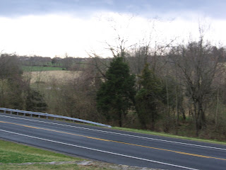
On Sunday, I tried to retrace the steps of Paul Jones Semmes' Brigade as they went into action in the West Woods. Most of the route is now within the NPS boundary but is separated by a bypass highway built in the 60s that connects Sharpsburg and Hagerstown. The highway pretty much runs between the battle lines of Gorman's Brigades (certainly the 15th Massachusetts and the 82nd New York) and Semmes' Brigade and elements of Jackson's Division. If I had all the money in the world, I would pay to have the bypass made into an underpass. That it was built in the first place to run right through the heart of the West Woods action tells us more about how we have viewed the significance of the conflict in this part of the field. What about a highway along the Sunken Road? Anyway, back to Semmes.

Semmes' route runs northeasterly between the Hauser farmstead and the buildings that made up the Alfred Poffenberger farmstead.

The Hauser farmstead was (and is) arrayed on a ridge by the same name. According to the 1860 Federal Census, the Hauser family consisted of Jacob Hauser, 36; his wife, Harriett, 30; and their eight children ranging from 10 years to 8 months. Also listed is Samuel Piper, a 20 year old "farm hand." Hauser listed his the value of his real estate as $5,000 and personal property at $400.

Less than a mile to the East is the Alfred Poffenberger farmstead. These buildings included a barn and the early 19th Century structure known as the Mary Locher cabin. The 1860 census shows Alfred Poffenberger, then 26, resided in the cabin along with his 22 year old wife Harriett, and one-year-old William. Also there were Emma Ziah, a 10 year old, and Peter Krutzer, who is listed as a 28 year old "farm hand." Poffenberger listed the value of his real estate at $3,000 and personal property at $500.

On the 17th, Semmes, a brigade in McLaw's Division, arrives at Sharpsburg sometime after 7 a.m. having marched all night from Harper's Ferry. Ezra Carmen writes that the brigade as it came on the field "was ordered by McLaws to move forward in line to the support of Stuart's cavalry and artillery on the extreme left. The brigade was then on the high ground near the Hauser house, numbered 709 officers and men, and from right to left was thus formed: the 32nd Virginia, 10th Georgia, 15th Virginia, and 53rd Georgia. " (Carman, 263).

Hauser farmstead and ridge in the middle distance. Foundation of the Poffenberger barn in the foreground.

Again from Carmen: "Semmes says, 'Immediately the order was given, 'by company into line,' followed by 'forward into line,' both of which movements were executed, in the presence of the enemy, under a fire occasioning severe loss in killed and wounded.' It advanced steadily two hundred yards, the left passing through the Hauser apple orchard under a severe fire from the 15th Massachusetts and the 82nd New York, when orders were given to commence firing (as Semmes says, at long range for most of the arms in the brigade) for the purpose of encouraging the men and disconcerting the enemy, and the effect was visible in the diminished number of killed and wounded."


Carmen continues: "Crossing the fence which ran nearly north and south just east of the Hauser house, the brigade--under murderous fire--charged across a stubble field, men falling at every step,

and was brought to a halt, the right at a rocky knoll very near the Alfred Poffenberger barn (which gave some protection from the galling fire(fn1) of the 15th Massachusetts on the hillside 130 yards distant) and the skirmishers at the barn and in the old wood road."

[Left. Looking south and west from the stone foundation of the Poffenberger barn to the Hauser farmstead and ridge in distance and the "stubble field" lying between.]

(fn1) Captain P.H. Loud reported that during this advance his 10th Georgia suffered "a most galling fire from the enemy's sharpshooters." {Loud's Official Report, Sept. 23rd, retrieved from http://aotw.org/exhibit.php?exhibit_id=142} The sharpshooters were probably the First Company, Massachusetts Sharpshooters (Andrew's Sharpshooters) who were attached to the 15th Mass.


Carmen: "The center and left of the brigade were under partial cover of the many projecting rock ledges. The conflict here was at close quarters and very severe, the entire brigade suffering heavily from the fire of the 15th Massachusetts, 130 to 190 yards in front, and an enfilading fire from the right. In advancing to this position and holding it a very few minutes, nearly one-half the brigade was killed and wounded...."


[Left. A farm lane ran from the direction of the Dunker Church northwesterly through the West Woods and then through the Poffenberger farmstead crossing between the barn and the cabin. Is this the trace of the original farm lane? It is currently a service road. In the far distance is the Locher cabin (under cover for preservation) and the foreground a storage cellar. The 15th Mass. is arrayed to the right of this photo.


Right.
An outcropping of rock approximately 12 feet high rises just
north of the barn, this is likely the "rocky knoll very near the Alfred Poffenberger barn."]


[Right. The view of the 15th Mass. of the Poffenberger barn just visible through the trees and Hauser's Ridge in the far distance--and the "stubble field." The Locher Cabin is out of the picture, just to the right. The offending bypass runs right through history.]


Walking the West Woods...in mud.


To be continued....